
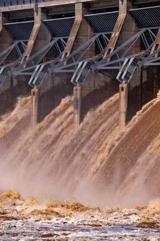
Arkansas River is receding in Northeastern Oklahoma as the U.S. Army Corps of Engineers scales back releases from the hydroelectric dam near Tulsa.
Storms dropped more than 20 inches of rain on parts of the region over the past month and pushed the Keystone Lake reservoir to record levels.
The river fell into the minor flood stage at about 7 a.m. in Tulsa County Friday morning, according to data from the National Weather Service. The river had climbed to the major flooding stage (over 23 feet) during the worst of the flooding.
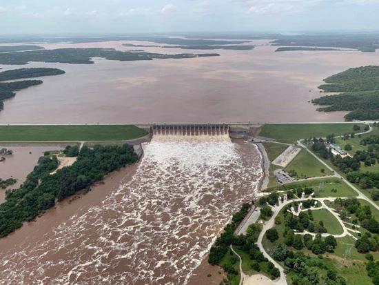
As the current photo of the Arkansas Dam above shows, the reservoir is pushing up it’s banks. The reservoir drains a watershed of about 22,000 square miles in Oklahoma and Kansas.
U. S. Army Corps of Engineers Lt. Col. Adam Weece said Thursday that releases into the swollen river have fallen from a high of 275,000 cubic feet per second Wednesday to 210,000 by Friday daybreak.
Public Radio reports Weece saying residents of flooded communities will see “a gradual and visible” decline in river levels over the next five days.
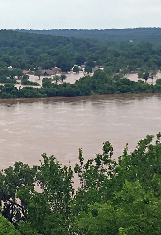
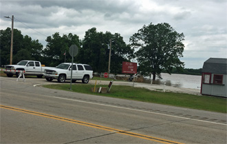
Further west near Cleveland Oklahoma Keystone lake is edging closer to roads and overwhelming recreational parks built as high water buffers with the lake.
With a clear day Friday, residents are thankful, but taking care not to assume the crisis is over. More rain is forecast within the next few days.
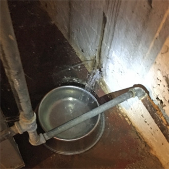
Few older homes have basements in Tulsa because the water table is so close to the surface, but one home just four miles east of the river experienced water bursting through the mortar of the wall from super saturated land surrounding the house.
Local broadcast news is well covering alerts and breaking news. For more click on any one of the following links: KTUL.com, KOTV.com, KJRH.com, KOKI.com.